
Richmond ZIP Code Coverage, Row by Row
Richmond's postal map contains ten codes with different roles. Some cover broad delivery areas that blend city neighborhoods with nearby unincorporated places. Others point to post-office boxes or special routing, so they are not neighborhood names. The table keeps the local labels tied to the research while leaving station names and special-code status open to a current USPS check.
| ZIP | Areas Covered | Post Office | Notes |
|---|---|---|---|
| 94801 | Central and west Richmond, Point Richmond, Iron Triangle, Santa Fe, North Richmond and Parchester areas | Richmond-area delivery; verify station by address | City and nearby unincorporated mailing geography |
| 94802 | Richmond post-office boxes | Richmond post-office boxes; verify current USPS result | Not a residential street-delivery area |
| 94803 | Eastern Richmond, El Sobrante vicinity, May Valley and adjacent county geography | El Sobrante or Richmond-area service; verify address | Municipal and unincorporated identities can cross |
| 94804 | South and central Richmond, Marina Bay, Coronado, Pullman and Richmond Annex vicinity | Richmond delivery; verify exact station | Postal label near El Cerrito and Albany is imperfect |
| 94805 | North & East and East Richmond Heights vicinity | Richmond delivery; verify exact station | Edges require a jurisdiction check |
| 94806 | Hilltop and San Pablo or Tara Hills vicinity | San Pablo or Richmond-area delivery; verify address | Large cross-jurisdiction ZIP; many addresses are outside Richmond city |
| 94807 | Richmond special-use routing | Verify with current USPS | PO-box or special-use role, not a general resident directory |
| 94808 | Richmond special-use routing | Verify with current USPS | PO-box or special-use role; confirm continued activity |
| 94820 | Unique or special Richmond-associated routing | Institutional or special routing; verify current assignment | Not a neighborhood ZIP |
| 94850 | Unique or special Richmond-associated routing | Institutional or special routing; verify current assignment | Not a general street-delivery ZIP |
94801, 94803, 94804, 94805, and 94806 are the main delivery-oriented entries in the research, yet each can carry a city or county edge. The research does not establish a ZIP split or realignment year. USPS post-office stations and the continued activity of special ZIPs must be verified for the exact address against current USPS results before a Richmond code is tied to a particular office.
Richmond ZIP Codes Carry Different Geographic Signals
A postal directory works best when Richmond areas are read as postal zones, not municipal wards. 94801 reaches central and west Richmond, Point Richmond, Iron Triangle, Santa Fe, and the North Richmond or Parchester mailing area. 94804 reaches south and central sections including Marina Bay, Coronado, Pullman, and the Richmond Annex vicinity. 94805 points toward North & East and East Richmond Heights, while 94803 reaches eastern Richmond, May Valley, El Sobrante vicinity, and adjacent county geography.
These labels matter because the next Contra Costa records custodian for a Richmond address follows the parcel, not the ZIP alone. USPS can confirm delivery routing. Richmond GIS, city boundary layers, permits, and the Assessor's parcel tools answer the jurisdiction question. Neither result, by itself, names the people connected to an address.
Why Richmond ZIP 94806 Crosses Jurisdictions
94806 is the clearest Richmond geography lesson. The research places Hilltop and the San Pablo or Tara Hills vicinity in this large ZIP, and warns that many addresses carrying 94806 are not inside Richmond city. North Richmond adds a related wrinkle: it is an unincorporated community with Richmond postal usage. A postal Richmond label cannot prove that Richmond municipal departments hold the next record.
For a Richmond family or neighborhood trail, keep the USPS city name, the incorporated city, and the parcel's actual jurisdiction separate. Richmond Annex near El Cerrito and Albany creates another edge case. The parcel map and city or county layer should settle jurisdiction before a ZIP result frames a resident search.
The City of Richmond Neighborhood Councils directory adds a community layer that can be compared with postal geography.
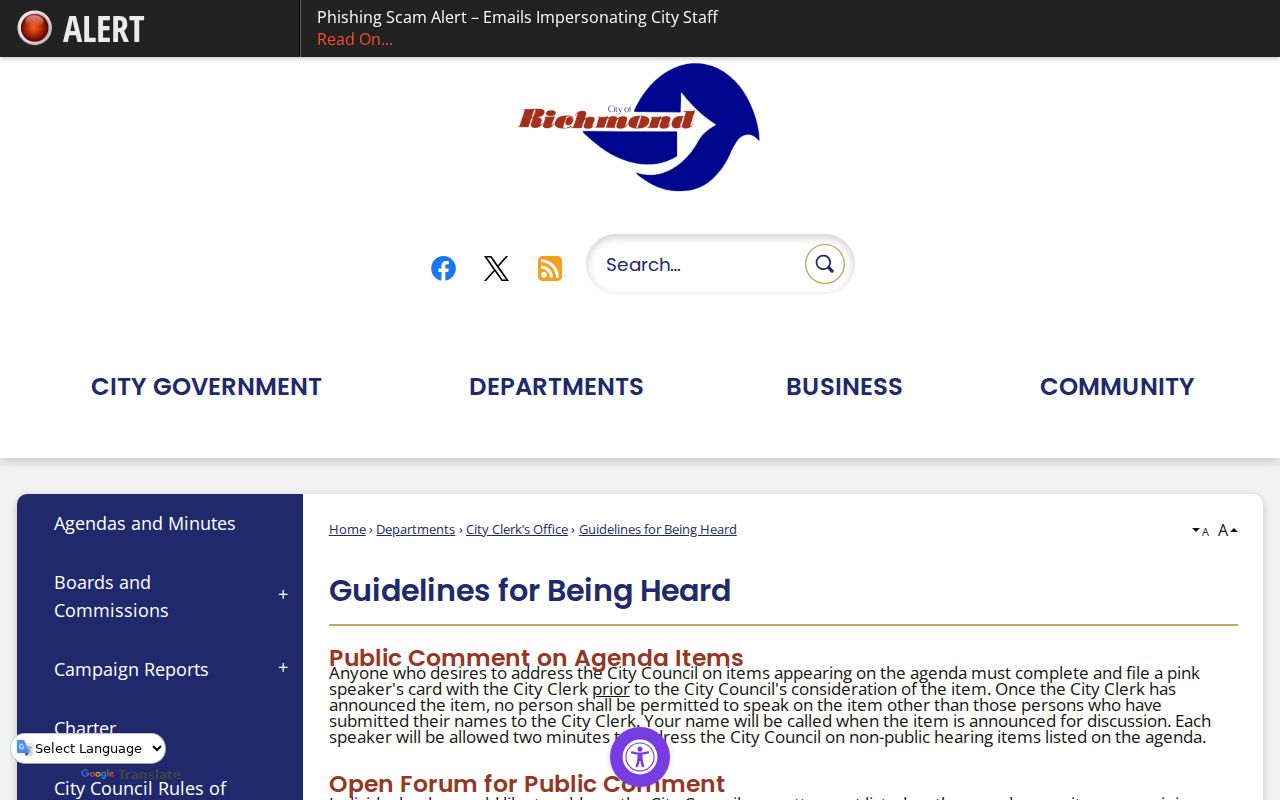
Council names and public meeting contacts help place a ZIP in local context, but they are not a private member list or a resident roll.
Find Richmond Residents by ZIP Code
Finding residents by ZIP code means narrowing a real address, then choosing the record that fits the question. Contra Costa tools do not document a ZIP-wide owner or resident filter. A careful sequence is:
- Verify the street address, unit, city, state, and ZIP with USPS. Note whether the result is street delivery, a PO box, or special routing.
- Use ParcelQuest Lite by address or APN, then use CCMAP to compare the parcel outline and jurisdiction layer.
- If ownership or tax mailing matters, use the Assessor's public roll or a precise existing-record request. Do not infer an owner from a missing web field.
- For street-level context, move from the confirmed address to the Richmond street directory; for voter data, use the controlled route below.
RecorderWorks is party-indexed from 1986 forward, not a ZIP-first resident list. Richmond permits shown online begin in May 1998, while older permit cards require a targeted city request. Those dates set limits when a Richmond ZIP trail reaches an address.
Checking a Richmond ZIP Code Through USPS
The official USPS city and state ZIP lookup is the right first check when a Richmond city label, unit, or ZIP is uncertain. It supports lookup by address, by city and state, and cities by ZIP. The captured view is a reference for the fields, not a promise that every special code returns the same result over time.
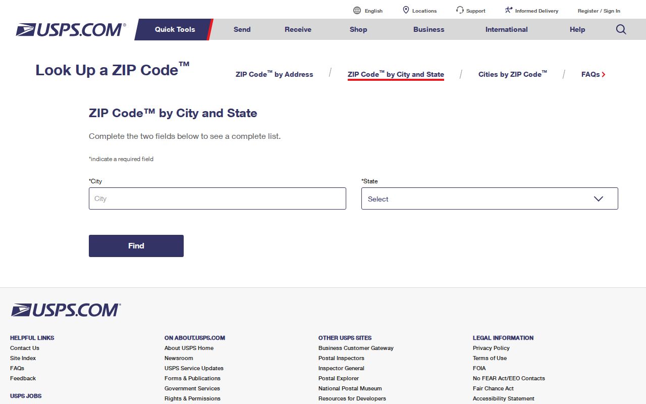
Enter the full Richmond street address and secondary unit when possible. A city and state search can suggest codes, but address-level confirmation is stronger. Check the live result before using a post-office label in a records request.
| Field Label | Type | Required | Options or Format Notes |
|---|---|---|---|
| Lookup mode | selector | yes | By address, by city and state, or cities by ZIP |
| Street address | text | address mode | Use the full situs address when available |
| Secondary unit | text | if applicable | Apartment, suite, or other unit detail |
| City and state | text and dropdown | city search | Use Richmond and California only when supported by the address |
| ZIP | text | ZIP search | Compare candidate city or delivery results |
| Find or Reset | buttons | action | Run, clear, or start a new lookup |
USPS confirms postal routing, not city limits, ownership, occupancy, or a public roster of residents. An exact station name is also address-specific. Verify the station and the continued activity of any special ZIP with current USPS results.
Mapping Richmond ZIP Addresses to APNs
After the USPS result is saved, map the Richmond address to a parcel. The county's property-information gateway links to ParcelQuest Lite and CCMAP. ParcelQuest accepts an APN or street address, with city as a supporting field. Some parcels have no situs address, so an APN is essential for vacant, shoreline, or hard-to-locate land.
ParcelQuest can show the APN, situs, land or use code, lot and land area, building size, assessed values, and a parcel-map link where present. The Richmond parcel card remains address and APN centered. CCMAP lets a researcher enter an address or APN, click the parcel, inspect outlines, use aerial and contour layers, and select a radius. Owner names are deliberately omitted from the web tools. The public assessment roll remains a counter or request channel, and the tax mailing address is not proof of who occupies the situs.
The useful Richmond chain is USPS ZIP to ParcelQuest APN to CCMAP jurisdiction to the Assessor roll or a precise request. That sequence narrows a ZIP without claiming that a ZIP-wide directory exists.
Richmond ZIP Voter Limits
California My Voter Status is a no-browse system. It asks the voter for first and last name, full date of birth, and a California driver license or ID number or the last four Social Security digits, then shows that person's authenticated registration information. It is not a public name directory and cannot browse a Richmond street or ZIP. A Richmond voter must authenticate their own record.
Qualified requestors may use the Secretary of State voter-file request process for a Richmond election question, scholarly, journalistic, political, or governmental purpose under Elections Code §2194. The research lists a $100 statewide file and up to ten specific voters at $30 each, capped at $100, with a county-specific route. These are controlled records, not a ZIP-wide resident filter.
Government Code §7924.000 keeps home street address, phone, email, precinct or identifier, prior registration data, driver-license or ID number, SSN, and signature confidential from ordinary disclosure. Safe at Home can give qualifying participants a substitute address and confidential voter registration, which explains why protected data may not surface in a postal or parcel search.
Where Richmond City Limits Meet ZIP Lines
ZIP lines and Richmond city limits answer different questions. USPS assigns delivery routes. Richmond, county, and parcel systems determine jurisdiction, services, ownership records, and legal descriptions. Preserve the exact ZIP, APN, situs, mailing address, and city label as separate fields so a postal result is not mistaken for a city resident list.
- ZIP code
- A five-digit USPS routing code for mail. It is not a legal boundary or a count of residents.
- ZIP+4
- Four extra digits used to narrow delivery to a smaller segment, building, floor, or unit when assigned. It is not a separate city.
- PO-box ZIP
- A code used chiefly for post-office-box delivery. A PO-box result does not describe a street neighborhood.
- Unique ZIP
- A special code for an institution or routing use rather than a broad neighborhood. 94820 and 94850 require current USPS verification.
- Carrier route
- A delivery-route grouping inside postal operations. It is not a parcel boundary, voter district, or public household list.
A ZIP code directory is most useful when it shows where a record search must split. USPS settles the mailing question. ParcelQuest and CCMAP settle the parcel question. The Assessor counter, city request channel, historical map, or controlled voter route may settle the record question. Current address results govern special codes and station assignments that the research could not capture.